Tenaya Lake

Sight·Yosemite National ParkRecommended by 2 publications
Tenaya Lake
Photo: Wikimedia Commons
“Tenaya Lake is an alpine lake in Yosemite National Park, located between Yosemite Valley and Tuolumne Meadows. The surface of Tenaya Lake has an elevation of 8,150 feet (2,484 m). The lake basin was formed by glacial action, which left a backdrop of light granite rocks, whose beauty was known to…”
— Wikipedia
Read more on Wikipedia →

In the coverage2 stories

Condé Nast TravelerSep 12

11 National Parks That Are Even More Beautiful in the Fall

Enjoy changing leaves in Shenandoah and cooler days in Big Bend.

25 things in this story
  • Tenaya LakeSightThe surface of Tenaya Lake has an elevation of 8,150 feet (2,484 m).
  • The AhwahneeHotelstay at a National Historic Landmark hotel
  • Tuolumne MeadowsNeighborhoodIts approximate location is 37°52.5′N 119°21′W.
  • Mist TrailTrailthree-mile trail
  • Tioga RoadSightwinding drive with photo opportunities
  • Rush Creek LodgeHotelpost-park wellness
  • Elsewhere
  • The PerchPlaceBig Bend National Park, United Statesstargazing oasis
  • Willow HouseHotelBig Bend National Park, United Statesbucket-list stay where design meets style
  • The Claremont HotelHotelAcadia National Park, United Stateshistoric guest rooms with a view
  • Cadillac MountainSightAcadia National Park, United Statesreservations required for sunrise viewing
  • Going-to-the-Sun RoadTrailGlacier National Park, United Statesclimbs through forests and alpine terrain to Logan Pass
  • Skyline DriveSightShenandoah National Park, United States105-mile scenic drive through park
  • Many GlacierSightGlacier National Park, United Statesstate of Montana.
  • Two MedicineSightGlacier National Park, United Statesstate of Montana.
  • Acadia Bike RentalsPlaceAcadia National Park, United Statesrent bicycles to cruise park carriage roads
  • Jordan Pond HouseRestaurantAcadia National Park, United Statespicnic spot famous for popovers with jam
  • TerramorHotelAcadia National Park, United Statesglamping option
  • Brandywine FallsTrailCuyahoga Valley National Park, United StatesOfficial websites use .gov A .gov website belongs to an official government organization in the United States.
  • The LedgesTrailCuyahoga Valley National Park, United StatesOfficial websites use .gov A .gov website belongs to an official government organization in the United States.
  • Towpath TrailTrailCuyahoga Valley National Park, United Stateshistoric canal locks for cycling
  • Valley OverlookHotelCuyahoga Valley National Park, United Statesstays inside the park
  • Glidden HouseHotelCuyahoga Valley National Park, United Statestaste of the Cleveland arts scene
  • Dark Hollow FallsTrailShenandoah National Park, United Statesrippling cascade hikers won't want to miss
  • Stony ManSightShenandoah National Park, United Statespanoramic views for photographers
  • Desert Sky HutPlaceBig Bend National Park, United States
Read the full piece at Condé Nast Traveler →

OutsideMar 25

These Permit-Free Adventures Are Just as Epic as Half Dome, Angels Landing, or Teton Crest

Did you miss the permit window for Angel’s Landing, Half Dome, or the Teton Crest Trail? We have 10 alternatives to keep your next outing epic, even if you didn’t nab a reservation.

Electric blue lake visible from Cloud's Rest.

22 things in this story
  • El CapitanSightThe granite monolith is about 3,000 feet (914 m) from base to summit along its tallest face and is a world-famous…
  • Cloud’s RestTrailStrenuous hike with panoramic 360-degree views.
  • Tenaya LakeSightElectric blue lake visible from Cloud's Rest.
  • The SpineTrailRocky, narrow route to Cloud's Rest summit.
  • Cathedral RocksSight
  • Elsewhere
  • Desolation WildernessTrailLake Tahoe, United StatesMoonscape with erratic rocks and open ridges.
  • Tahoe Rim TrailTrailLake Tahoe, United States167-mile loop around Lake Tahoe.
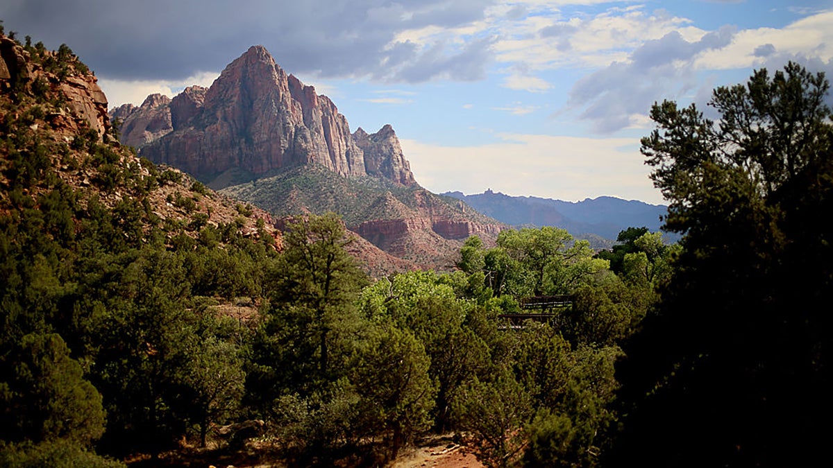
  • Watchman TrailTrailZion National Park, United StatesShort hike with broad vista of river valley.
  • Washakie Pass LoopTrailWind River Range, United States36.5 untamed miles in the Wind River Range.
  • Cirque of the TowersSightWind River Range, United StatesHorseshoe-shaped, many-spired peaks above 12,000 feet.
  • Alice-Toxaway LoopTrailSawtooth Wilderness, United States18.8-mile loop through Sawtooth Wilderness.
  • Coyote Gulch Loop TrailTrailGrand Staircase-Escalante National Monument, United StatesSlot canyon hike with arches and natural bridges.
  • Jacob Hamblin ArchSightGrand Staircase-Escalante National Monument, United StatesArch in the landscape, good resting spot.
  • Virgin RiverSightZion National Park, United StatesAquamarine river cutting through desert sandstone.
  • Beaten PathTrailRed Lodge, United StatesTrek through Beartooth-Abroska Wilderness.
  • Beartooth HighwayPlaceRed Lodge, United StatesRoute 212 in Montana and Wyoming between Red Lodge and the Northeast entrance of Yellowstone National Park.
  • Alice LakeSightSawtooth Wilderness, United StatesAlpine lake with sunrise reflections of El Capitan.
  • Toxaway LakeSightSawtooth Wilderness, United StatesAlpine lake with flat, sun-baked slabs.
  • Twin LakesSightSawtooth Wilderness, United StatesAlpine lakes flanked by granite slopes.
  • Buckskin GulchTrailWire Pass Trail, United StatesLongest continuous slot canyon, requires scrambling and wading.
  • Lizard Head PlateauSightWind River Range, United StatesHighest point on Washakie Pass Loop with wraparound views.
  • Watchman PeakSightZion National Park, United States
Read the full piece at Outside →
↑↓ to navigate · Enter to open · Esc to close